Hampta Pass Trek
An Enchanting Cross-Over from Manali to Spiti
Available Batches
Available Batches


Brief Description
Brief Itinerary
Detailed Itinerary
Day 1
Manali (2,050M) to Chikka (3,048M) via Jobra (2,743M) (Click to View GPS data)
Distance: 16 kms (Manali to Jobra) + 3 kms (Jobra to Chikka)
Duration: 1 hour drive + 2 hours trek
The first boarding point is the Manali bus stand. The scheduled time to report there is 9 AM. The journey begins at 10 AM. We drive to Jobra through Prini. The 16 kilometers of drive which takes up to 1 hour takes us through sharp curves and bends. Three kilometers from the Manali bus stand, the roads gain height and lead towards the mountains through Prini. As we gain height, we witness the massive Beas River flowing through the vibrant Manali city in the valley below us. The view of Manali soon fades as we drive forward and a stream of smooth clouds envelope the massive landscape around us. While driving through the clouds we can see huge pine and small apple trees accompanying us on both sides of the road. An hour later, we reach Jobra which is situated right next to the famous Allain Duhangan Hydropower Plant.
Trek from Jobra (2,743M) to Chikka (3,048M)
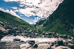
The actual trek for Hampta Pass begins from Jobra. After settling down in Jobra, we start walking through a lush green forest filled with maple, deodar, and oak trees. This day is easy as we cover a distance of 3 kilometers in 2 hours. After a few minutes into the trail, small streams of the Rani nalllah accompany us on our left. Then, we cross a rustic wooden bridge and continue walking beneath the trees for the next 1.5 km. At the end of the forest line, the trail opens up to the valley towards Chikka. From here, the path gradually ascends and is lined with moist logs and boulders on either side. After 2 kilometers, the landscape reveals its many surprises. There are small flowers and shrubs alongside the river and horses by the dozen grazing through the shrubs in free spirit. Our first campsite of the trek, Chikka, is at the end of this elevation (about 3 kms from here).
Day 2
Chikka (3,048M) to Balu Ka Ghera (3,600M) (Click to View GPS data)
Distance: 5 kms
Duration: 7 hours
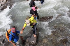
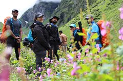
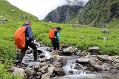
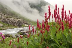
Today, we cover a distance of 5 kilometers in 7-8 hours and gain a bit more altitude (600 meters). After an early start at around 8 AM, we cross a small wooden bridge and begin our ascent. Because of the persistent and unpredictable rains, the first 2 kilometers of moderate ascend are likely to be filled with mud and slush. A little further into the trail, the flow of Rani nallah changes towards the right-hand side. There’s something very refreshing about water bouncing off the small boulders lined along the stream, its sprinkles hitting us in the face taking away the fatigue that comes with walking on the trail. We experience the first river crossing of the trek after 2.5 kilometers. This river crossing is a gateway to the colorful meadows of Jwara, a huge stretch packed with flowers that boast of all the hues of the colour spectrum. Lunch break at Jwara is equivalent to a picnic at a park. The trail from Jwara gets easy with minimal ascends and runs closer to the river. It turns completely flat 4 kms from here. On the right-hand side of the track, you can spot small pockets of land between the water stream with unusual orchids and small birds. This magical pathway leads us straight towards Balu Ka Ghera, the second campsite.
Day 3
Balu Ka Ghera (3,600M) to Hampta Pass (4,200M) to Shea Goru (3,900M)
Distance: 9 kms
Duration: 7 hours
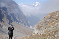
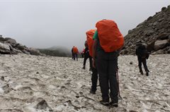
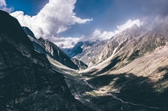
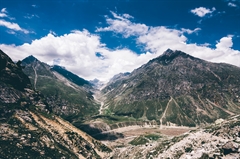
Day 3 is the longest and toughest day of the trek. Today, we cover a distance of 9 kilometers in 7 hours and gain an altitude of 600 meters. Early in the morning, we leave Balu Ka Ghera at 6:30 AM and walk along the Rani nallah. For 1 kilometer, the trails are paved in a zigzag manner because of the huge boulders. After a while, the valley opens up and a huge frame of the river runs parallel with us. When we cross 2 kilometers, the trails get steeper and steeper with heavy ascents and turns. The higher we climb, the thinner the river becomes. The last source of fresh water and greenery ends at the 3km mark and a dry trail of snow and rock begins. The path on the snow is vigorous and the weather is likely to be unpredictable for the next kilometer. Hampta Pass lies at the end of this trail. The pass is a small stretch that leads us to Lahaul. The trails directly descend with a 50-degree steep slope from the pass. This descent continues for the next 3 km. Loose sand, mud, and big boulders can make the stretch challenging to navigate during rains. The trail offers you some relief once you cross this stretch for the final 2 kms is flat and straight. It leads us directly towards Shea Goru, the third campsite.
Day 4
Shea Goru (3,900M) to Chhatru (3,350M) & drive to Chandratal Lake (Click to View GPS data)
Distance: 5 kms + 70 kms
Duration: 4 hours trek + 3 hours drive
The second river crossing of the trek happens on the glacial stream near the campsite. Crossing through the river from Shea Goru is one of the most adventurous assets of the Hampta Pass trek. On this day, we cover a distance of 5 kilometers in 4 hours. We cross the river around 7 AM and start descending downwards. The powerful Chandra river rushes on our left-hand side. Expect to reach the campsite, Chhatru, around 11 AM.
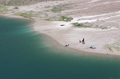
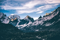
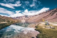
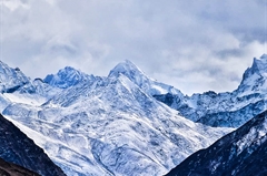
At Chhatru, we assemble in the nearest roadway and start driving towards the stunning Chandra Tal Lake. It takes 3 hours and 70 kilometers to reach the lake. The incomplete roads, dangerous curves, flowing streams make for a complete off-road driving experience. Throughout the drive, you can witness the marvelous snowcapped Spiti range on both sides of the road. The serene lake is situated at a height of 4,250 meters and after a brief stop, we return to our campsite in Chhatru by night.
Note – The route to Chandra Tal Lake is prone to landslides. In case of any such news, the drive will be canceled.
Day 5
Chhatru (3,350M) to Manali (2,050M)
Distance: 60 kms
Duration: 1.5 hours
On the final day, we pack and leave early for Manali by around 7 AM. The distance between Chhatru and Manali is 60 km and it takes 1 hour 30 minutes to reach the Manali bus stand. On the way, while we exit Spiti, we find many army tents and small check posts. Close to 45 minutes into the drive, we enter the infamous Atal tunnel. We reach the final stop before noon; you may plan your return journey accordingly.
What's Included
- Veg Food (Day 1 Lunch till Day 5 Breakfast).Three Meals a day
- Transportation from Manali to Manali with Chandratal Lake
- Forest Permits/Camping Charges/Permits, Trek Permit Fee/IMF Permission (Upto the amount charged for Indian nationals)
- Camping tents - Twin sharing, Temp rated sleeping bags, mattress
- Helmet, Micro spikes and Gaiters, if required
- Mountaineering course certified Trek Leader with First Aid certification
- Experienced Local guide, cook, helpers
- Porters or mules for carrying common luggage
What's Not Included
- Meals during road journeys
- Offloading of personal bags
- Emergency Evacuation Cost
- Any kind of Insurance
- Any expense of personal nature
- Any expense not specified in the inclusion list
Are you Eligible for this Adventure?
Hampta Pass Trek is for those who have prior experience in trekking to altitudes higher than 3000 meters.
BRS Level Required
This makes it mandatory for you to have high-altitude experience of preferably multiple treks marked at level 3 on the BRS. The altitude, the terrain, and the nature of the climb demand a certain level of endurance and a need for you to be aware of how your body reacts to the various features of the high-altitude environment.
If you do not know what level of BRS trek would suit you best, worry not! Fill out this Form:
we will send you a progression chart to help you comfortably get out of your comfort zone in order to level up and ultimately reach your highest potential in the big, bad world of outdoor adventure.
Packing List
This is a list of essential items for individuals doing the trek with Bikat Adventures. This list contains only those items which the participants are required to bring with them. The list excludes those items which are provided by Bikat Adventures on the trek. We have divided the items into five categories. All the items in the list are essential except for those marked as optional.
Trekking Gear
- Ruck sack bag with rain cover. Qty -1
- Day Pack Bag - Recommended for treks with summit day
- Head Torch with spare Batteries. Qty -1
- U V protection sunglasses. Qty -1 Here is how you can choose the best sunglasses for trekking.
- Water Bottles: 2 bottles of 1 liter each
Footwear
- Non-skid, deep treaded, high-ankle trekking shoes Qty -1
- Pair of light weight Slipper/Sandals Qty -1
Clothing
- Quick Dry Warm lower or Track Pants. Qty - 2
- Full sleeves T-shirts/ Sweatshirts. 1 for every 2 days of trekking
- Pair of thick woolen socks. 1 pair for every two days of trekking
- Thermal Body warmer Upper & Lower. Qty-1
- Undergarments. Qty - 1 for every day of trekking
- Warm jacket closed at wrist & neck .Qty-1
- Full sleeves sweater. Qty -1
- Rain wear ( Jacket & Pants ) . Qty-1
- Pair of waterproof, warm gloves. Qty-1
- Woolen cap. Qty-1
- Sun shielding Hat. Qty -1
Toiletries
- Personal toiletries kit (Small Towel, Toilet paper, paper soap, Bar soap, toothbrush, toothpaste, cold cream, etc.)
- Sun screen lotion small pack. Qty -1 Here is your Sun Protection 101 to stay safe in the bright sunny outdoors.
- Lip Balm small pack. Qty-1
Utensils
- Small size, Light weight & Leak proof lunch box. Qty-1
- Plate. Qty- 1
- Spoon.Qty-1
- Tea/Coffee (plastic) Mug.Qty-1
Miscellaneous
- Camera (Optional)
- Carry your medicines in plenty in case you have any specific ailment. Consult your doctor before joining the trek.
- Dry fruits, Nuts, Chocolate bars (Optional)
Frequently Asked Questions
Why Bikat?


Small Group Size
Our batch sizes are capped at 15 for smaller treks with the trek leader and trekker ratio of 1:8. This ratio, in our years of experience, has proven to deliver the best trekking experience for individuals as well as groups. Capping the size of the group ensures individual attention to each trekker so that no signs of distress or need during the trek go unnoticed. It also helps to form a more cohesive cohort with better group energy which helps define the rhythm and pace of days on the trek. As you go higher up on the BRS scale, since the stakes are higher, expeditions have an even smaller group size with the ratio of expedition leader to climber set at 1:2.


Qualified Trek Leaders
We follow a rigorous regime of hiring and training our experts in the field. Each trek leader is a certified mountaineer with years of experience in the field. In addition to their qualification, they also go through practical and situational training to tackle any and all kinds of sudden conditions that may present themselves on the ground. Being unpredictable is the core nature of the mountains but being ready for any circumstance as best as possible is a controllable asset that we try to nurture. Our field experts are also trained in basic medicine and first-aid response. Watch: Forerunners - The Making of A Trek Leader At Bikat Adventures


Guided Progression
Since Bikat Adventures is a learning-based organization, we help you climb up the ladder of difficulty within the sphere of outdoor adventure systematically. Our on-ground training modules are designed to handhold you through the upskilling process so that you are ready to take on bigger challenges.


Equipment Quality and Check
All the gear used on our treks and expeditions is tried and tested, maintained for good quality, and is overall top-notch in quality and condition. We are continually looking to obtain the best of everything there is in the market so as to ensure optimum safety.


Support Systems
Along with the staff you see on-ground, we have a team of superheroes working in the background to give you the best experience possible. Our background team also comprises local staff from each area who know the region best. Having local support helps with studying the area, pre-planning, execution, and in receiving timely support in case of emergencies in these remote locations.


Communication
Our on-field staff is in constant contact with our teams based in primary locations so as to eliminate any avoidable delay in reaching additional help and support when required. We try to use the best tools for communication available, including satellite phones, in regions where they are not restricted.
What our customers Say
Cancellation Policy
Cash refund
Cancellations up to 30 days prior to departure date
Cancellations between 30 days to 15 days prior to departure date
Cancellations within 15 days prior to departure date
Voucher refund
Cancellations up to 5 days prior to departure date
Cancellations within 5 days prior to departure date
- Cash refund is applicable only in case of bookings made without using any promotional offer code or vouchers
- This is only a brief of cancellation terms. For finer details please refer Detailed Cancellation Policy.
Blog Posts


Similar Adventures

Deo Tibba Base Camp Trek
The Chhota Chandratal Trek
Himachal
6 Days
BRS 4
4480 m

Ghepan Ghat Lake Trek
Hidden Gem of Himachal
Himachal
5 Days
BRS 4
4146 m

Miyar Valley Trek
The Yosemite of the Himalayas
Himachal
8 Days
BRS 4
3990 m
