
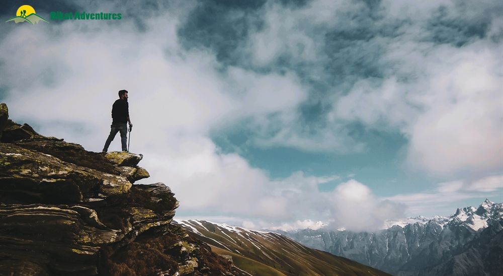
Sar Pass Trek
For all adventure souls who like snow and high mountains
Available Batches

Brief Description
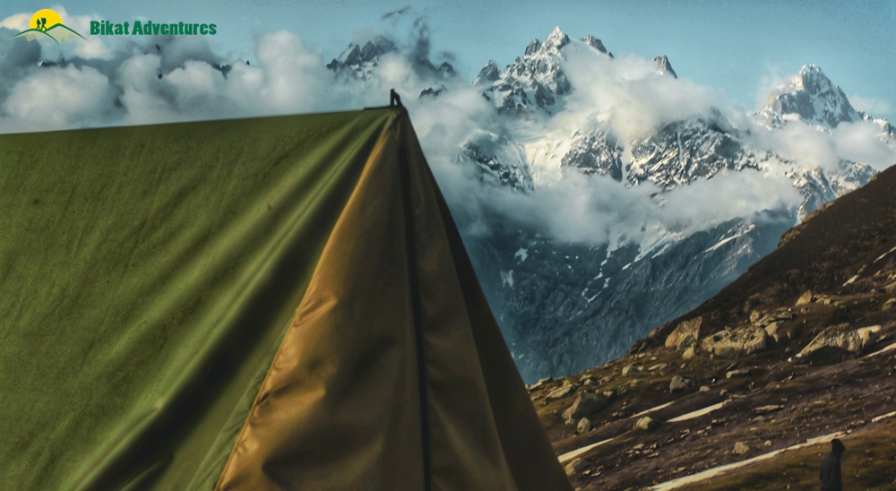
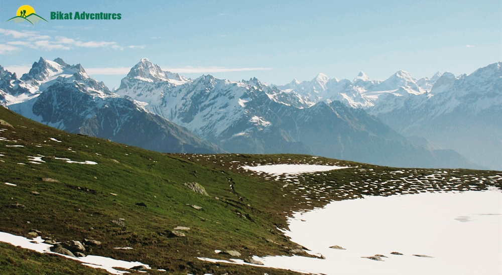
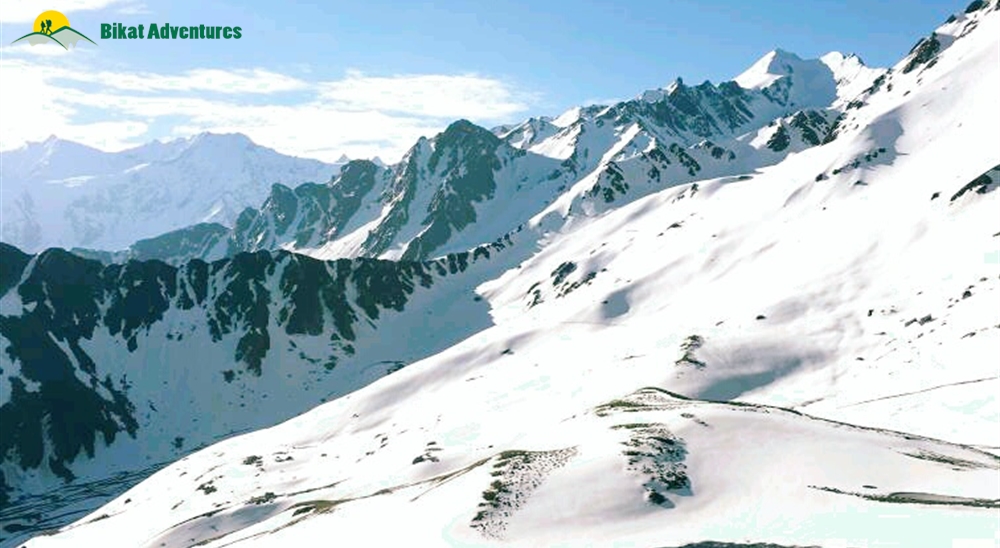
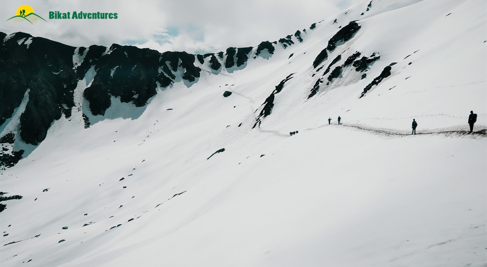
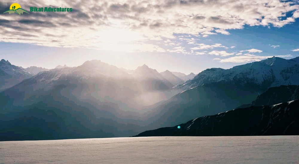
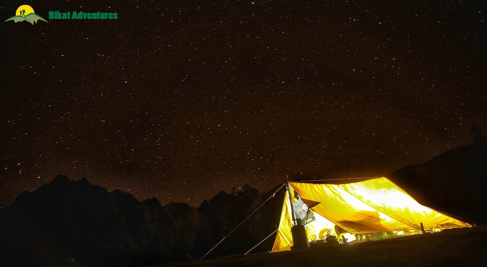
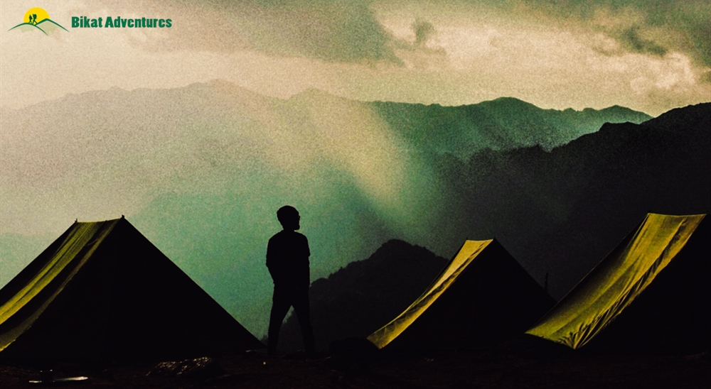
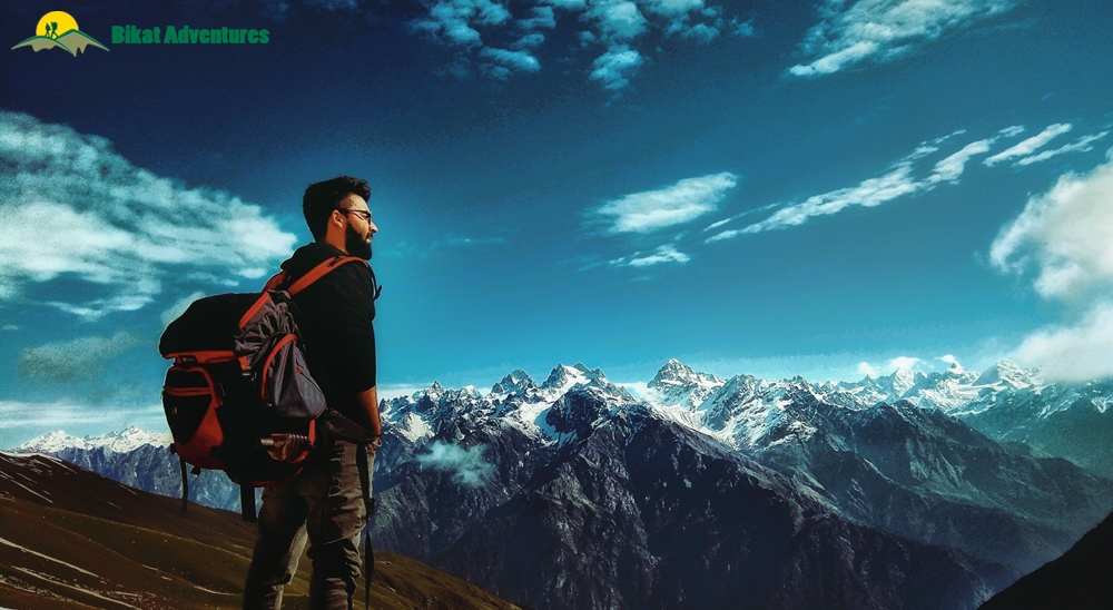
Gallery

Brief Itinerary
8 Km
4 Hours
3546m
8 Km
4 Hours
3546m
8 Km
4 Hours
3546m
8 Km
4 Hours
3546m
8 Km
4 Hours
3546m
Detailed Itinerary
Day 1
Arrive at Kasol (1,580M) and trek to Grahan (2,300M)
Distance: 8 kms trek
Duration: 5 hours
We assemble at Kasol market by 09:30 AM. Keep enough buffer time in your hand to reach Kasol; these roads are prone to jams and delays. If possible, get here a night before so that your day doesn’t feel too packed and rushed.
From the busy market, we turn a corner and reach the forest which is the starting point of the trek. Here, we do our briefing and distribute your rental + equipment. Packed lunch will be provided, too. There are enough water sources on the way today. We start our trek on the right side of a stream of glacial water which is going to be our companion throughout the day. Once in the forest, the temperature instantly drops by 5 degrees.
You will find small dhabas along the way which serve Maggi, rhododendron juice, biscuits and chai. The first six kilometres of today’s trail is a motorable road but with splashes of green everywhere. The last 2 kms is when we start to ascend on a walking trail to get to Grahan village. The first 6 kms should take us close to 3-4 hours to cover. And the last 2 kms of steep section with a 300M ascent should take us between 1-2 hours.
Expect to reach the homestay between 2 and 3 PM. Settle in and wait for the sunset magic to begin!
Day 2
Grahan (2,300M) to Min Thatch (3,285M)
Distance: 4 kms
Duration: 5 hours
The ascent today is quite massive – close to a 1000M in a short distance of 4 kms. Remember to pace yourself and take it slow to avoid getting sick. We are walking through forests so thick, that you will see the sunlight visibly struggling to make its way to you. Spider webs gleam in the sparse sunlight like holograms. There are no water sources today, carry at least 2l of water with you as you start.
We leave after breakfast at 9 AM. Once we cross the village, we descend for a short while from where we cross a small wooden bridge to get to the other side of the Grahan nalla – it is now all uphill from here. There is a dirt path leading us to Min Thatch. On the rocky, uneven ground, stones and the thick roots of the trees act as makeshift stairs – remember to exercise caution at every step.
At the mark of 1 km, after an ascent of 180M, we reach a small clearing – a patch of almost flat land which is a welcome change. A kilometre and a half more from here, after an ascent of 450M, we reach a dhaba. Packed lunch is provided for today. You can also choose to indulge in some Maggi and omelettes at the dhaba. The food here tends to be a bit on the expensive side – check for prices before you order.
We have half way more to go after this lunch point. The route is on similar terrain. In 2 more hours, we reach a massive meadow with a carpet of the brightest purple wildflowers you ever saw. This is Min Thatch (thatch meaning meadows), our campsite for today, bordered by thick forests and rhododendron bushes to your right and a wide view of the valley and the skies to the left. The sunsets from here are glorious.
Day 3
Min Thatch (3,285M) to Nagaru (3,850M)
Distance: 3 kms
Duration: 3 hours
Today we are heading to the highest campsite of the Sar Pass Trek, Nagaru. We leave by 9 AM. After a 20M ascent, there’s a short patch of flat land. From here on, it is a steep uphill walk. Once we leave the campsite, we quickly cross through the end of treeline on this trek – enjoy the shade while you can because after the first 10 minutes, we are exposing ourselves to the full force of the sun and the winds. After 300M of ascent, we hit the first dhaba for today – this one serves Siddhu (a local Himachali delicacy) in addition to the regulars! We have packed lunch for today as well, but feel free to indulge in some mid-mountain hospitality. Shortly after the dhaba, we reach a section called ‘the rope point’. When there is ample snow, this 70 degrees steep section gets very slippery and very dangerous. We set up ropes at this point as a climbing aid and safety measure. When the landscape is dry, it can be crossed without ropes. After this ascent, follow the rhododendron bushes to stay on trail. After a continuous ascent of 450M, we reach a clearing. You can see the campsite from here. There are only some slippery slopes of ice between you and the safety of your tent now.
The trek today is short but difficult because of the steep ascents. Depending on the season, the trail may be covered in snow or be barren. The campsite at Nagaru has snow at all times. Since it is a wide-open clearing, the winds here can get menacing, hold on to your tents at night! Views of endless rows of snowclad mountains of the Parvati range grace this campsite – the sunsets here are exceptional. The Pass from here is so close, you can see it from your tents!
Day 4
Nagaru (3,850M) to Biskeri Thatch (3,400M) vis Sar Pass (4,223M)
Distance: 8 kms
Duration: 10 hours
Today is the day we reach the Pass we had been admiring since last evening. Even though it looks close, it takes 2-3 hours to get to. The distance is close to 1 km with a 300M gain in altitude. If we hope to catch the sunrise from the top, we leave by 3 AM and start the climb in darkness – expedition style! Get your head torch ready, put on your gaiters and microspikes and be ready by 02:30 AM. We fill our bottles, have some breakfast under the stars and leave. The 2-3 hour ascent is in snow, it is an uphill climb which is quite steep. Take it slow but keep moving to avoid your body from getting cold. We make it to the top of the Pass just as the peaks of Parvati Valley start to take on a golden hue. There’s nothing like the alpenglow of dawn to get the best photos of this wide landscape. In this world of white, take some time to look over and identify some popular peaks. We leave after spending an hour at the top.
The main challenge of the day is the long descent to Biskeri Thatch, our campsite for today. After we cross the massive snow field that is Sar Pass, we descend down for a bit. The path takes us horizontally across the mountain on quite an angled slope. There is one more steep ascent left for the day – the one to Biskeri Top that is almost at the same height as the Pass. After we make our descent and traverse across mountains on a narrow path, we make the steep ascent over slippery terrain all the way to Biskeri Top. This half a kilometre of stretch will only take about 15 minutes to cover but it will definitely knock the air out of us! Once at the top, it is only downhill from here. When it is snowy, we can slide down and save our legs some effort but when the snow has receded, we have to walk down this long slope.
At 4.5 kms, we reach the last dhaba on our trail. From here the route gets easier. Thick with rhododendrons, it is a pleasant walk all the way to Biskeri Thatch. It is a campsite amongst tall trees and singing birds – our last night in tents. The snow-clad mountains give way to jagged, rocky peaks. Welcome to warmth!
Day 5
Biskeri Thatch (3,400M) to Barshaini (2,210M) and drive back to Kasol (1,580M)
Distance: 5 kms
Duration: 3 hours
Today is our last day on the Sar Pass trek. The trail is all downhill through pine forests. The descent is easy towards Pulga and across Parvati River to reach the village of Barshaini. Our team will be waiting at Barshaini to drive you to Kasol. It is a two hour drive - expect to reach Kasol by late afternoon. Plan your journey ahead accordingly.
What's Included
- Veg Food (Day 1 Lunch till Day 5 Breakfast). Three Meals a day.
- Forest Permits/Camping Charges/Permits, Trek Permit Fee/IMF Permission (Upto the amount charged for Indian nationals).
- Camping tents, Temp rated sleeping bags, mattress
- Safety Equipment includes static rescue rope, seat harness, carabiners, pulleys
- Mountaineering course certified Trek Leader with Wilderness Emergency Responder & Rescue.
- First Aid Certified Local guide, cook, helpers
- Porters or mules for carrying common luggage
- Last day transportation from Barshaini to Kasol
What's Not Included
- Meals during road journeys
- Any kind of Insurance
- Any expense of personal nature
- Carriage of personal rucksack
- Meals during Hotel Stay
- Any expense not specified in the inclusion list
Are you Eligible for this Adventure?

BRS Level Required
Although fairly easy, any kind of activity in high altitude requires a certain level of physical fitness and endurance for it to be a pleasant experience.
If you do not know what level of BRS trek would suit you best, worry not! Fill out this Form:

we will send you a progression chart to help you comfortably get out of your comfort zone in order to level up and ultimately reach your highest potential in the big, bad world of outdoor adventure.
Packing List
This is a list of essential items for individuals doing the trek with Bikat Adventures. This list contains only those items which the participants are required to bring with them. The list excludes those items which are provided by Bikat Adventures on the trek. We have divided the items into five categories. All the items in the list are essential except for those marked as optional.
Trekking Gear
- Ruck sack bag with rain cover. Qty -1
- Day Pack Bag - Recommended for treks with summit day
- Head Torch with spare Batteries. Qty -1
- U V protection sunglasses. Qty -1 Here is how you can choose the best sunglasses for trekking.
- Water Bottles: 2 bottles of 1 liter each
Footwear
- Non-skid, deep treaded, high-ankle trekking shoes Qty -1
- Pair of light weight Slipper/Sandals Qty -1
Clothing
- Quick Dry Warm lower or Track Pants. Qty - 2
- Full sleeves T-shirts/ Sweatshirts. 1 for every 2 days of trekking
- Pair of thick woolen socks. 1 pair for every two days of trekking
- Thermal Body warmer Upper & Lower. Qty-1
- Undergarments. Qty - 1 for every day of trekking
- Warm jacket closed at wrist & neck .Qty-1
- Full sleeves sweater. Qty -1
- Rain wear ( Jacket & Pants ) . Qty-1
- Pair of waterproof, warm gloves. Qty-1
- Woolen cap. Qty-1
- Sun shielding Hat. Qty -1
Toiletries
- Personal toiletries kit (Small Towel, Toilet paper, paper soap, Bar soap, toothbrush, toothpaste, cold cream, etc.)
- Sun screen lotion small pack. Qty -1 Here is your Sun Protection 101 to stay safe in the bright sunny outdoors.
- Lip Balm small pack. Qty-1
Utensils
- Small size, Light weight & Leak proof lunch box. Qty-1
- Plate. Qty- 1
- Spoon.Qty-1
- Tea/Coffee (plastic) Mug.Qty-1
Miscellaneous
- Camera (Optional)
- Carry your medicines in plenty in case you have any specific ailment. Consult your doctor before joining the trek.
- Dry fruits, Nuts, Chocolate bars (Optional)
Frequently Asked Questions
The Sar Pass Trek, at BRS 4, is suitable for both beginners. However, it helps if you have some high-altitude experience for this trek to be enjoyable.
If you can Jog/Run for 3 kms in 25-30 mins, you are ready to take on this trek. In addition to this, you can also add resistance workouts to your schedule like squats, lunges, push ups etc.
If you cannot do the above, there’s no need to worry. It is important to remember that it’s all about practice. Get on a training schedule and we can assure you that you will meet these standards in a matter of a few months.
This is a beginner-friendly trek. You don’t need any major skills to be a part of this adventure. However, a certain level of fitness and physical endurance are required to take on any high-altitude trail in the Himalayas. Everything else, you can learn during your outdoor experience.
The minimum age limit is 9 years. However, minors between 9 to 17 years of age should be accompanied by their parents/ guardians. If you are above the age of 60, kindly carry a medical certificate from your doctor that deems you fit for adventure activities like trekking.
The Sar Pass trek is located in the Parvati Valley of the Kullu district in Himachal Pradesh. The trek starts from the small village of Kasol.
One of the main highlights of this trek is the stunning scenic beauty that it offers. The trek takes you through dense forests, alpine meadows, and snow-covered mountain passes, offering breathtaking views of the surrounding Himalayan peaks, including Shivalik and Dhauladhar ranges. Another highlight of the trek is crossing the Sar Pass at an altitude of 4,223M, which is a challenging yet thrilling experience for trekkers. Additionally, the trek offers an opportunity to interact with locals from remote villages, learn about their way of life, and experience their culture and traditions. The hot springs in Manikaran, which are believed to have therapeutic properties, are also a highlight of the trek. The beautiful campsites along the way, including the picturesque Grahan village, are another highlight of the Sar Pass trek, making it an unforgettable experience for those seeking adventure, natural beauty, and cultural immersion in the Himalayas.
The trek involves passing through challenging terrain, including steep ascents and descents, which can be physically demanding and tiring. The weather conditions can be unpredictable, with sudden changes in temperature, rain, and snowfall, which can make the trek more difficult.
The trek is open for a short window of 3 months between mid-April to mid-June.
On trekking days we have twin-sharing tents. In case you want an individual tent, you can add that to your booking request for an additional cost.
During the summer months (May to June), the temperature at the base of the trek in Kasol can range from 15-25°C, while at higher altitudes it can drop to around 5-10°C during the day and even below freezing at night.
Sar Pass Trek is not considered technically challenging, but it can be physically demanding due to its length and the altitude gain. The trek takes you through some steep climbs and rocky terrain. However, it is a beginner-friendly trek and can be done by anyone who is physically fit.
The starting point of Sar Pass trek is from Kasol. Kasol is a hamlet in the Parvati valley of Himachal Pradesh. It is 520 km from Delhi. There are public buses running between Delhi and Kasol. Kasol is easily accessible through road, rail and air transport.
By Road: The distance between Delhi and Kasol is 520 km. There are frequent buses from Delhi to Kasol. Most of them are not direct buses so you will have to take an HRTC bus from ISBT Kashmere Gate, Delhi towards Manali and change the bus at Bhuntar (30 km from Kasol) and reach Kasol either by a local bus or a private taxi. There are very few direct buses from Delhi to Kasol but they are run by private companies. You can also hire a taxi or outstation cab from Delhi to Kasol.
By Rail: To reach Kasol by railways you have to get off at the nearest railway station to Kasol which is Joginder Nagar railway station, about 144 km from the village of Kasol. You can take a cab from the station to reach Kasol or a bus from the Joginder Nagar Bus Stand towards Manikaran which should take about 4.5 to 5 hours.
By Air: The nearest airport to Kasol is almost 31 Kms away, Bhuntar Airport located near Kullu. It is connected to three cities Delhi, Pathankot and Shimla. You can hire local cabs or private vehicles from there to reach Kasol.
Till Kasol you will get impeccable network. At Grahan, you may not get network, but wi-fi at the guesthouse is available. After Grahan, there are a few patches on the trek where Jio and Airtel networks are available eg: at the Nagaru Campsite and other smaller patches enroute. However, don’t rely on getting network here at all times.
There are plenty of ATMs in Kasol.
Since the trek starts from Kasol, the journey has to be arranged by yourself. However, transportation on the last day of the trek from Barshaini to Kasol will be arranged by us. We will meet in Kasol Taxi stand by 9 am and start our trek.
Expect to reach Kasol late in the afternoon. Make sure your bookings from this point to your respective destinations are late in the night.
There are a number of places to visit around Kasol in the Parvati Valley. Manikaran, a pilgrim site with its hot springs, is a famous attraction near Kasol. The waters of the hot springs are believed to have medicinal properties. There are plenty of hiking trails from Kasol to its surrounding villages like Choj, Chalal, and Rashol. One can also visit the quaint village of Tosh by a private or a shared taxi. A day hike to the famous Kheerganga, a spiritual destination with hot springs, can also be done from Barshaini.
All the common gear like tents, sleeping bags, mattresses etc. are provided. All the technical climbing equipment (as required) are also provided to you. For this trek, you will also be provided microspikes to safely cross the icy terrain on the trek. Safety equipment used for rescue is carried by our trek leaders.
You can rent trekking shoes, trekking poles, a fleece jacket and a rucksack from us. In case you have any other requirements, you can talk to our representative and we will be happy to assist you in any way that we can.
You will receive your rented equipment in Kasol, on Day 1.
Our trek leaders will collect the rented equipment from you at the end of the trek on the last day.
For a detailed list, check the Packing List section on this page.
Kasol has a reasonably sized market. However, we will have to head to Grahan and there will be no time for shopping. Please do not leave anything for last minute buying.
Although not recommended, you can off load your bag at an additional cost. Add a request while making your booking for the trek and it can be arranged. Please note: the cost of offloading on this trail is controlled by the locals. At INR 1000 per day for a weight limit of 10 kgs, it is considerably higher than on other treks.
(Note: We don’t recommend offloading because the extra resources on a trail - ponies or porters depending on the trail - means extra load on the environment which can easily be avoided. It also goes against the spirit of trekking by eliminating a level of endurance and discomfort from the experience which are factors at the very heart of an outdoor adventure activity.)
(Note: We don’t recommend offloading because the extra resources on a trail - ponies or porters depending on the trail - means extra load on the environment which can easily be avoided. It also goes against the spirit of trekking by eliminating a level of endurance and discomfort from the experience which are factors at the very heart of an outdoor adventure activity.)
We do not provide this service in Kasol. You can either drop your luggage at our store in Katagla which is 3 kms away from the main market at Kasol or you can check with your hotel if they could store your luggage for the duration of the trek.
On all trek days, we provide 3 full meals (breakfast, lunch & dinner) in addition to evening snacks and tea. The meals are vegetarian and the menu is pre-decided for all days of the trek. We do provide eggs as well on certain days. If you have any specific food-related allergies or restrictions, you can let our local staff (during the trek) know, and your requests will get accommodated. We try to provide a variety of food across meals so as to avoid repetition as well as cover all nutritional needs.
On campsites, our team will dig dry pits and assemble a toilet tent to provide for safe and secure quarters. A shovel will be provided within the toilet tent as well. Using water in the toilet tent is restricted; you will need to carry your own toilet paper. On the more difficult expeditions, toilet tents are not carried to the higher camps (above base camp) due to restriction of space (to pitch the tent).
In case you get your period on the trail and don’t have sanitary napkins, our trek leaders can provide them to you. If you need any other kind of assistance, you can let our trek leaders know. Irrespective of gender, our leaders are gender sensitised and equipped to assist you in any way you need them to.
Our team carries a first aid kit and all the basic medicines required during the trek. They are equipped to be the first responders in case of any injury or health-related issues. For higher expeditions, we also carry a HAPO Bag and oxygen cylinders to tend to any altitude-related health conditions.
You will get charging points at the guesthouse in Grahan village, but the electricity here is fluctuating. On leaving Grahan, we will be camping in the wilderness with no access to electricity.
A copy of your ID Proof and Medical Certificate are the mandatory documents required for this trek. (Soft copies for all of these are to be sent to us & originals should be on your person while on the trek.)
Yes, insurance for any high-altitude activity is highly recommended to cover for the cost of rescue, evacuation and any other emergency service required as well as to cover for medical cost in case of injury or illness during the trek. You can buy it on your own. Alternatively, if you want us to buy it on your behalf, you can speak to our post-booking team and they will arrange it for you. They will send you a payment link once the insurance has been purchased.
Yes, there are multiple permits required for this. We obtain the permits on every trekkers’ behalf. All the permit costs are included in your trek cost.
Yes, you will receive e-certificates (of completion) after the trek. It will bear your name, the trek, and the maximum altitude you achieved on the trek. In case you were unable to finish the trek, you will get a certificate of participation.
On completion of the trek, the certificate will show up on your dashboard on our website. You can download it directly from there.
Sar Pass Trek is in India. If you are coming from outside, you will need a visa to enter the country. You should be able to find the rules for obtaining a Visa based on your home country on the internet. This information is easily available.
This does not apply to you if you are an Indian citizen. In case you don’t hold an Indian passport, you will need to check online for Visa application rules based on your home country.
If you are not an Indian citizen, you will need Travel Medical Insurance to travel to the country. Please make sure that your insurance policy is valid for the altitude you are going to and the activity you are undertaking, to cover risks during the trek. The insurance policy provided by Bikat Adventures does not cover foreign nationals. So, please do not purchase it while making the booking from our website.
The Himalayas house the tallest mountains in the world and have long been a treasure trove for all adventure enthusiasts. The variety in terms of beauty, terrain, landscape, geography, culture and opportunity for adventure in the Himalayas, remains undisputedly unmatched.
You can make the booking any time depending on availability of slots in our fixed departure batches. You will get this information at the top of this page.
A Basic Mountaineering Course certification from one of the five recognized mountaineering institutes in India is a minimum requirement to join our team. Our field experts are also trained in basic medicine and first-aid response. We also conduct on-ground training for our staff once a year as a refresher for old skills and to learn some new ones. During this training that we call APW (Adventure Professional Workshop), our leaders learn close to 25 topics and techniques of rescue which are not covered in the BMC and AMC courses. For practical training, we simulate on-ground situations to prepare them for quick thinking and quick response during emergencies.
We follow a rigorous regime of hiring and training our experts on the field. Each trek leader is a certified mountaineer with years of experience in the field. The interview process to bring a trek leader on-board is close to 6 months long where we assess various skills as well as personality traits of an individual. They also go through an on-field assignment as part of the hiring process. Trek leaders also progress in time from leading easier treks before advancing to the more difficult ones where the stakes are higher. For detailed information on our selection process, please visit Forerunners - The Making Of A Trek Leader
It absolutely is. We recognize, value and embody the ideology that the world of outdoor adventure can benefit from diversity. We make it our mission to create outdoor spaces as equally accessible and safe for all genders as possible. We also encourage women leaders in the outdoors and all of our staff (irrespective of gender) is gender sensitised. As for accommodation, in case there are no other women on the trek, a solo female trekker is provided with a separate single-occupancy tent.
Our batch sizes for Sar Pass Trek are capped at 15 with the trek leader to trekker ratio of 1:8.
In addition to their qualification, our trek leaders are trained to tackle any and all kinds of sudden conditions that may present themselves on ground. During our recce stage, we study the trail in great detail and map out rescue routes before opening it up for our trekkers. We also have local support staff stationed in each area to arrange for emergency services at the place of need as quickly as possible.
We mobilise road rescue efforts where our trek leaders bring the person to be rescued down to the trailhead of the trek from where a car can take them to the nearest healthcare facility. The cost of rescue is not covered in the trek fee that we charge. It must be borne by the participant. However, if you opt for the insurance the cost of rescue operations can be claimed from the Insurance company on production of valid proof e.g. doctor’s prescription & hospital bills etc. Please note that Bikat Adventures is only a facilitator & not a party in the Insurance policy. You need to raise the claim request directly with the Insurance company. Bikat Adventures is not responsible for any rejection of claim. You can call the insurance provider directly for any clarifications related to the Insurance policy. Although not mandatory, we recommend buying the insurance. You don’t necessarily have to get the insurance we provide, you can pick an Insurance company of your choice and get a policy directly from them. If you need more information on the terms and conditions of the insurance policy, get in touch with our customer support team.
All the gear used on our treks and expeditions is tried and tested, maintained for good quality and is overall top notch in quality and condition. We are continually looking to obtain the best of everything there is in the market so as to ensure optimum safety.
That will depend on the nature of your medical condition. Do give us a call, and one of our people will help you understand what is best for you. If not this, we are sure there would be plenty of other options you can choose from our vast portfolio to pick as your next adventure.
We have rolling camps on all our trails. To know why we are strictly against the concept of Fixed Camping, read Reasons to Ban Fixed Camping in Himalayas
This is a complex question and has a compound answer. The simple response is that because it is bad for the environment which we dearly love but if you are interested in a more detailed response to this question, please read Reasons to Ban Fixed Camping in Himalayas
There are a number of measures that we take to prevent overcrowding on some of the most popular trails. Some of them are capping our group size at 15, capping the number of trekkers on a trail to 250 per season, constantly looking for newer trails and routes to spread the crowd around and providing incentives to our trekkers to try unexplored territories with us. We put in place the system of dynamic pricing, which is the first of its kind in the trekking industry, which incentivises trekkers to choose less crowded trails by offering higher discounts. We have noticed, since we started this system, that this has helped in a big way to spread out the crowds between trekking routes. We are also going international so as to relieve some of the stress on the Himalayan landscape as well as explore newer ranges and design newer experiences for our community. If you want a more detailed description of all our measures in this regard, please read Simple solutions to overcrowding on Himalayan Treks
Some basic things to remember are: do not use water, do not dispose of anything non-biodegradable inside the pits, carry your own roll of toilet paper and remember to cover up after yourself to leave a clean toilet for your fellow trekkers. Everything else is much the same like using an Indian style home toilet!
Most wet wipes are not biodegradable which means it could take 100 years or more for them to decompose – not the best thing if you are trying to ‘Leave No Trace’, right?
This is quite a tricky situation but not a hopeless one. Since most of our sanitary waste is not biodegradable, we recommend that you pack your pads/tampons neatly, store it in a zip-lock bag and bring it back down with you where there are better options to dispose of them. In case you do not have zip-lock bags, ask our trek leaders for them and they should be able to provide them to you.
Each trekker is responsible for the use and hygiene of their own eating utensils. And as a measure to maintain proper hygiene, we do not provide plates and spoons. Also, dipping your hands in cold water to wash your own utensils adds something to the overall joy of high-altitude living, wouldn’t you think?
On making the payment, you will receive a booking confirmation along with the packing list and a copy of the undertaking form via email. You will subsequently receive emails detailing documents required, how to prepare physically and mentally for the trek, information on pick-up location on the first day etc. Please add info@bikatadventures.com in your trusted emails list to make sure our emails don't go to your spam folder.
A Whatsapp group will be formed a few weeks before departure. Members from our team are on those groups as well. Feel free to seek any clarifications you require in regards to the trek, on the group itself. Updates related to transportation/pickup point/pickup timing, accommodation etc. will be shared on the Whatsapp group as well.
Yes, we create a Whatsapp group a few weeks before the departure date so that the flow of information remains smooth and transparent.
Yes, it is one of the mandatory documents you will need to submit before the trek starts. The soft copy is to be sent to us & the original should be on your person while on the trek.
Yes, we will provide you an undertaking form through email which will need to be filled up by you and submitted to us post booking.
Why Bikat?

Small Group Size
Our batch sizes are capped at 15 for smaller treks with the trek leader and trekker ratio of 1:8. This ratio, in our years of experience, has proven to deliver the best trekking experience for individuals as well as groups. Capping the size of the group ensures individual attention to each trekker so that no signs of distress or need during the trek go unnoticed. It also helps to form a more cohesive cohort with better group energy which helps define the rhythm and pace of days on the trek. As you go higher up on the BRS scale, since the stakes are higher, expeditions have an even smaller group size with the ratio of expedition leader to climber set at 1:2.

Qualified Trek Leaders
We follow a rigorous regime of hiring and training our experts in the field. Each trek leader is a certified mountaineer with years of experience in the field. In addition to their qualification, they also go through practical and situational training to tackle any and all kinds of sudden conditions that may present themselves on the ground. Being unpredictable is the core nature of the mountains but being ready for any circumstance as best as possible is a controllable asset that we try to nurture. Our field experts are also trained in basic medicine and first-aid response. Watch: Forerunners - The Making of A Trek Leader At Bikat Adventures

Guided Progression
Since Bikat Adventures is a learning-based organization, we help you climb up the ladder of difficulty within the sphere of outdoor adventure systematically. Our on-ground training modules are designed to handhold you through the upskilling process so that you are ready to take on bigger challenges.

Equipment Quality and Check
All the gear used on our treks and expeditions is tried and tested, maintained for good quality, and is overall top-notch in quality and condition. We are continually looking to obtain the best of everything there is in the market so as to ensure optimum safety.

Support Systems
Along with the staff you see on-ground, we have a team of superheroes working in the background to give you the best experience possible. Our background team also comprises local staff from each area who know the region best. Having local support helps with studying the area, pre-planning, execution, and in receiving timely support in case of emergencies in these remote locations.

Communication
Our on-field staff is in constant contact with our teams based in primary locations so as to eliminate any avoidable delay in reaching additional help and support when required. We try to use the best tools for communication available, including satellite phones, in regions where they are not restricted.
What our customers Say


Cancellation Policy
Cash refund
Cancellations up to 60 days prior to departure date
Between 60 days upto 30 days prior to departure date
Between 30 days upto 10 days prior to departure date
Less than 10 days prior to departure date
Voucher refund
Cancellations up to 30 days prior to departure date
Between 30 days upto 15 days prior to departure date
Between 15 days upto 10 days prior to departure date
Less 10 days prior to departure date
Please Note:
- Cash refund is applicable only in case of bookings made without using any promotional offer code or Cancellation Vouchers or Discounts
- This is only a brief of cancellation terms. For finer details please refer Detailed Cancellation Policy.
Blog Posts

Know How
There will be no sugarcoating in this article- traveling solo as a woman is invigorating, weird, terrifying and a whole host of other adjectives.
Society glorifies it, but people still seem surprised when they come across a girl who has picked up he...
Read full

Know How
How to use a trekking pole: 101
To use or not to.
It is an unending debate when it comes to the topic whether to use a trekking pole or not. You will always find people divided into two groups- against and in favor of using the pole on a tr...
Read full

Informative
11 Best Offbeat Treks in India
Offbeat Treks, the moment you hear this word, you start imagining untouched and pristine treks with the virgin beauty of shimmering waterfalls and breathtaking landscapes.
Well, I am convinced as your imaginat...
Read full

Know How
How to avoid shoe bite and treat blisters during hiking!
Foot blisters on the trek can make your trekking experience from awesome to awful in no time. The rough terrain and trails take a toll on your feet resulting in the blisters. Add dirt,...
Read full

Informative
Top Five Trekking Essentials
Are you planning to go on a Trek?
Great!
However, it must be said that depending on your level of preparation, your trekking experience could either be a lifelong memory or a harsh learning lesson. It i...
Read full

Know How
How to select a perfect pair of trekking shoes?
Give a trekker a right pair of trekking shoes, and he or she can conquer any mountain.
That being said, a pair of trekking shoes is the most important gear for a trekker. A tre...
Read full

Informative
Best Treks In India
The Indian Himalayan range spans over six states namely, Jammu & Kashmir, Himachal Pradesh, Uttarakhand, Sikkim, Arunachal Pradesh, and West Bengal.
As adventure lovers, we have always been at an advantage ...
Read full

Informative
20 Best Himalayan treks you can take this summer!
Are you too looking forward to the summer season with great eagerness? For the snow to melt? For the life to revive again?
Me too!
The snow will begin to melt in the mountains, once again, ...
Read full
Similar Adventures

Panwali Kantha Trek
Uttarakhand
5 Days
BRS 3
3500 m

Dev Kyara Trek
Hidden Gem of Uttarakhand
Uttarakhand
7 Days
BRS 4
4100 m

Ali Bedni Bugyal Trek
The Next Chapter of Roopkund
Uttarakhand
6 Days
BRS 3
3535 m


