
Kalindi Khal Expedition
The Toughest Expedition of India
Difficult
Gangotri to Badrinath
Kalindi Khal Expedition
Uttarakhand
15 Days
99 Km
Max 15
₹
98000
+ 5% GST
Add ons
Transportation Cost
(to be paid on the spot)
DDN to Gangotri
Badrinath to DDN
Sumo
(Shared by 5-6 trekkers)
Tempo
(Shared by 11-12 trekkers)
₹8000
₹13000
₹10000
₹14000
Available Batches
Available Batches

Brief Description
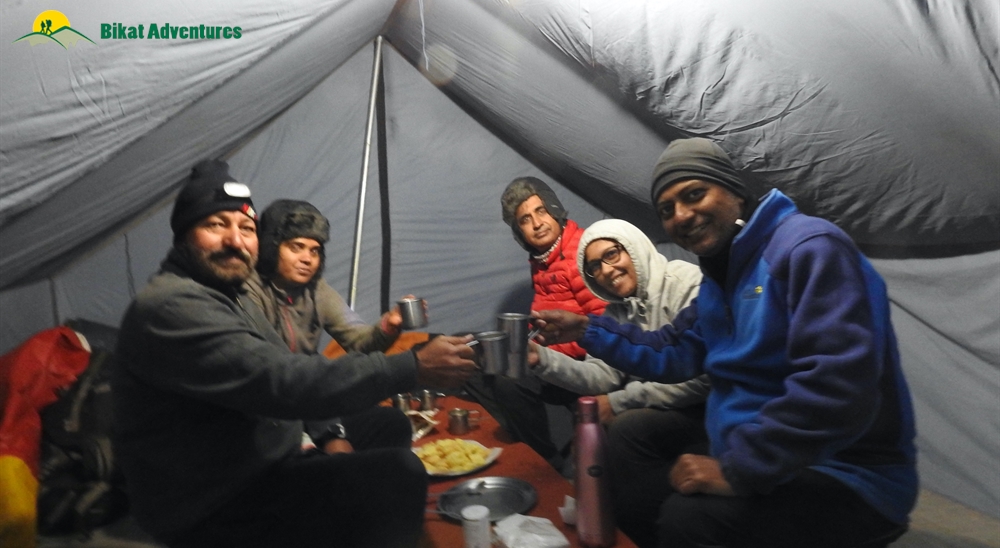
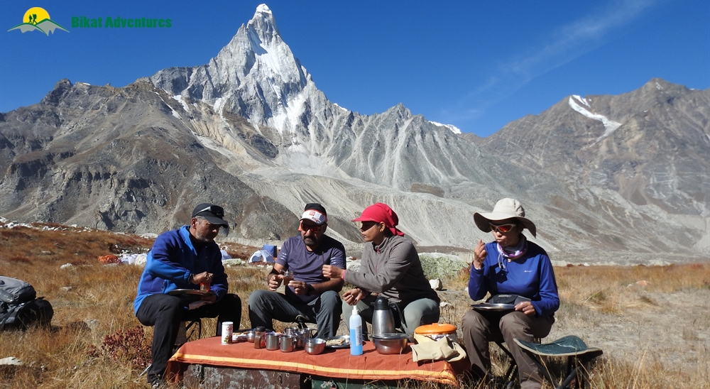
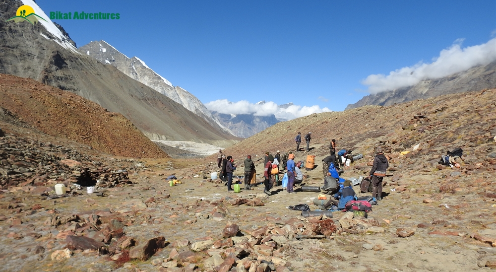
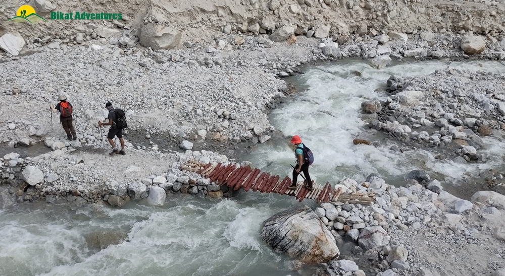
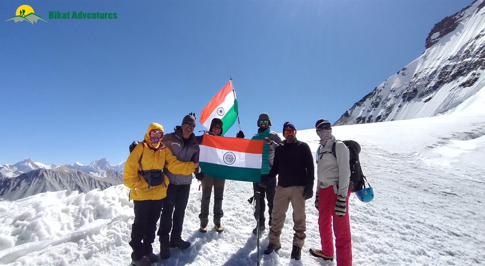
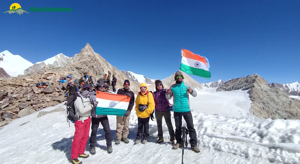
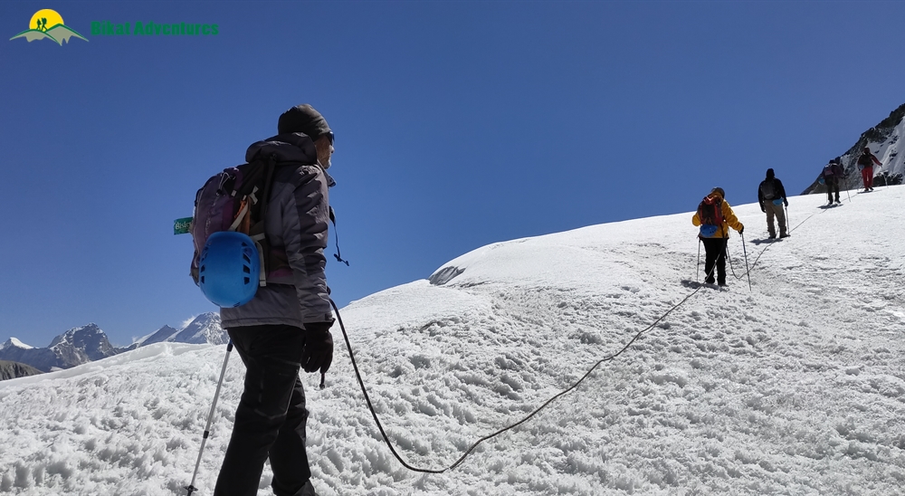
Gallery
Brief Itinerary
Detailed Itinerary
Day 1
Arrive in Gangotri
The only way to reach Gangotri is by road. You should reach by 3 PM. One can start the road journey either from Dehradun or Rishikesh but with a new route open now, reaching Gangotri via Dehradun is the faster option (around 242 Kms). You will receive the detail of accommodation in Gangotri through an email from us. After reaching here, check into the Guest House/Hotel. Have some rest. The evening can be utilized to explore the local market, temples, etc.
Day 2
Rest & Acclimatisation in Gangotri
Rest and Acclimatization in Gangotri.
Day 3
Gangotri to Bhojwasa (12,467 ft) - 14 km
We start in the morning, after breakfast to trek towards Chirbasa (3600 m). From Gangotri, you may move along the beaten track towards Chirbasa, which is on the tree line. The entire trek till Chirbasa is along the roaring Bhagirathi River. We can have our pack lunch in Chirbasa. From Chirbasa, we trek further to Bhojwasa today. The trek is going to be moderate for the day. The terrain, after Chirbasa, becomes really desolate and barren. In fact, it has been referred to as Arctic Tundra by many trekkers. The entire trail passes through the dense forest till Bhojwasa. There is a small temple and a potential campsite near the river. Good place to camp for the day. Excellent sunset on Bhagirathi group of peaks to delight you in the evening.
Day 4
Bhojwasa to Tapovan (14,632 ft) via - Gomukh (12,795 ft) - 13 km
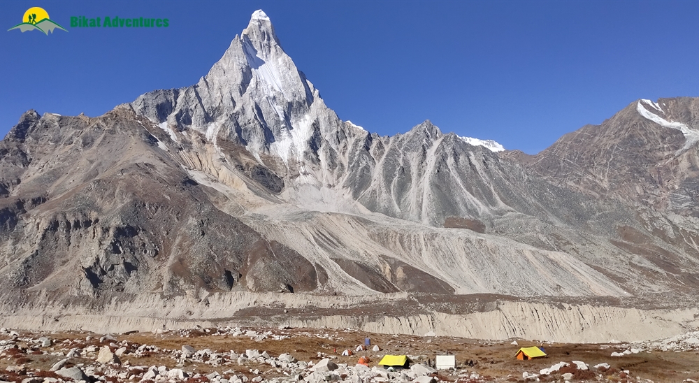
Early in the Morning enjoy the panoramic view of the Bhagirathi group of peaks. After breakfast trek to Gomukh (3890mt), the source of the Ganges. Gomukh is where the water of Ganga trickles down from the glaciers. The sages called it 'Gomukh' because, in the distant past, it probably appeared like a cow's mouth. Explore the area and trek to Tapovan, one of the finest high altitude alpine meadows in the area. The trek from Gomukh to Tapovan is ascent steep, and as we climb, the view of the surrounding peaks becomes clearer. Tapovan known for its beautiful meadows that encircle the base camp of the Shivling peak, Tapovan is a very pleasant surprised spot with a large meadow complete with bubbling streams, wildflowers, and campsites. Herds of Bharal (blue mountain goats) are a common sight from here on mountain ridges. On the far side of the glacier the Bhagirathi I, II, III (6454mt), provide an equally impressive backdrop. It is also the little wonder where Sadhus and saints choose this spot for extended meditation during the long summer month. Arrive Tapovan and camp. Dinner and overnight stay in camp.
Day 5
Tapovan to Nandanvan (14,271 ft) via Meru Glacier - 8 km
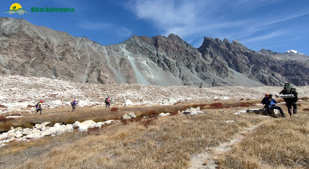
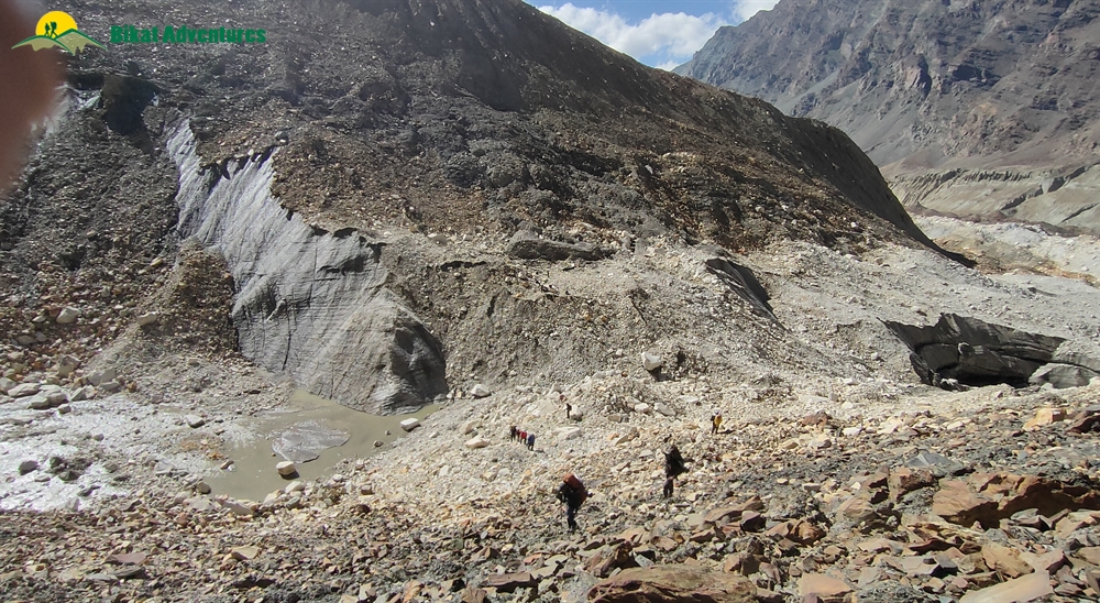
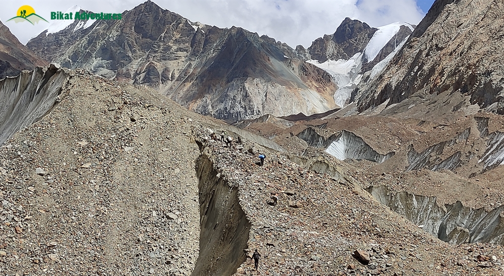
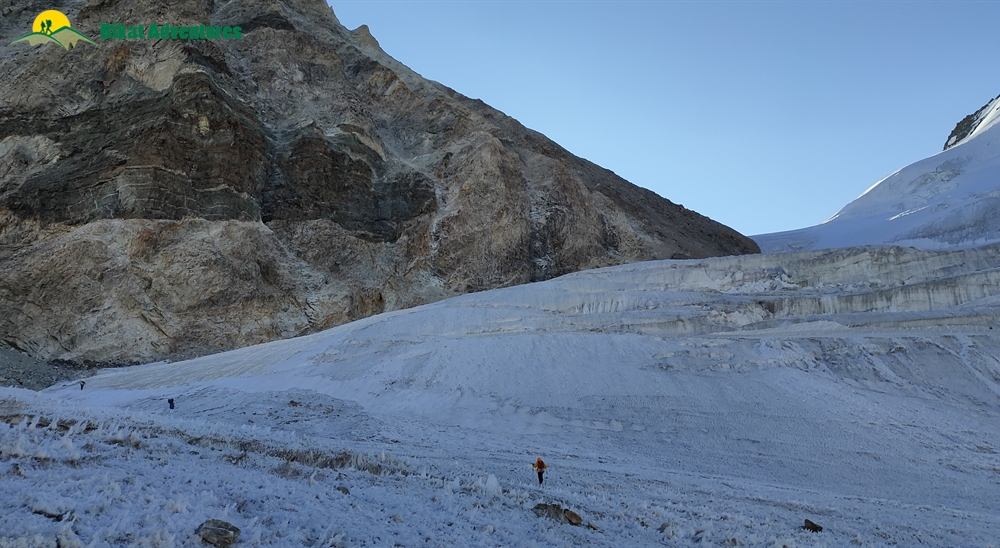
On this day we start early & head to the great Meru Glacier. After a brief halt to explore Meru Glacier, we trace back to Nandanvan via Gomukh glacier. The route from Tapovan leads from the upper section of the meadow till down and onto the glacier. From Gomukh turn towards Nandanvan (4340m) and steering on right one will be on top of the Gangotri glacier. The glacier runs between two ranges and the landslides make a layer of rocky moraine on the ice which makes the walking easier. The glacier walk is very slippery and a slight lack of concentration would be dangerous. Huge crevasses gaped here and there. After walking for about a kilometer there is a vertical ascent. Big rocks en route offer grips and footholds but many of them are deceptive too. Dinner and overnight stay in tents.
Day 6
Nandanvan to Vasuki Tal (16,010 ft) - 6 km
Morning trek along with Chaturangi Glacier to reach Vasuki Tal, a beautiful base for Mt Satopanth and Mt Vasuki Parbat with a small lake. The trek is steady upward.
Day 7
Rest & Acclimatization at Vasuki Tal
Rest and Acclimatization Day at Vasuki Taal
Day 8
Vasuki Tal to Khara Patthar (17,060 ft) - 6 km
Today's trek is of 6 hrs duration. View of Mount Sathopanth makes the whole experience worthwhile. It is one of the only two 7000+ meter peaks in India.
Day 9
Khara Patthar to Sweta Glacier (17,880 ft) - 8 km
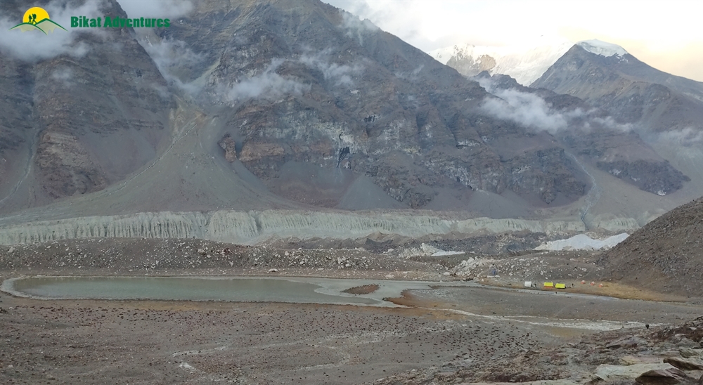
Today's trek is of relatively short duration. The campsite is a moraine area filled with rocks and boulders, not an ideal campsite but is a must for acclimatization purpose.
Day 10
Sweta Glacier to Kalindi Base Camp (18,569 ft) - 6 km
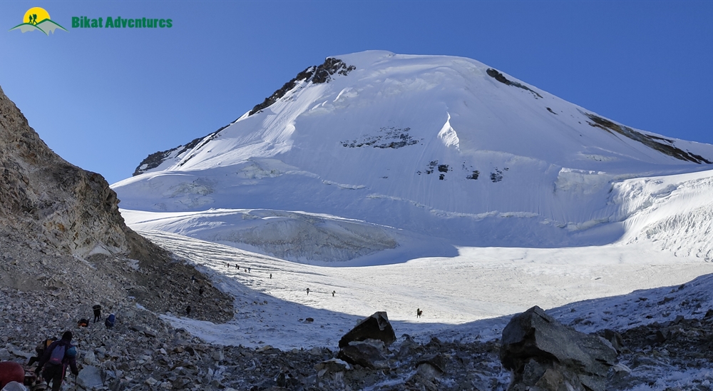
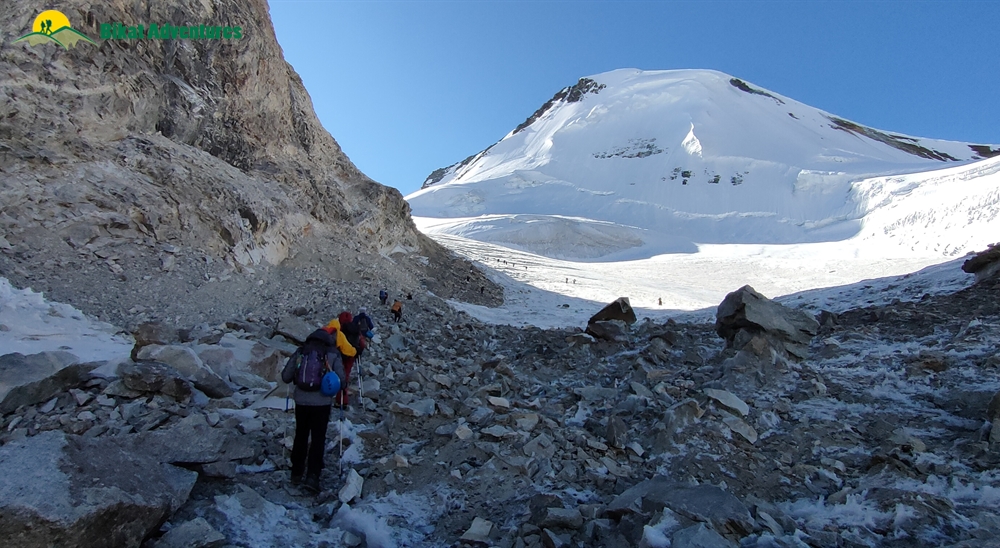
We will start our day early today. It's a short walk but since most of the trek will be in moraine area it's always good to have time in hand. On the way is Chatrungi Glacier which got its name because of 4 colors (pink, yellow, brown, green) as are visible at this place. This glacial flow from this glacier forms major tributary for Gangotri Glacier. Camping site for today is Kalindi Bhamak which is close to the snout of Kalindi Glacier. Kalindi Khal/Pass is just up ahead an opening between Avalanche and Kalindi Peak.
Day 11
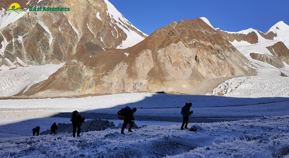
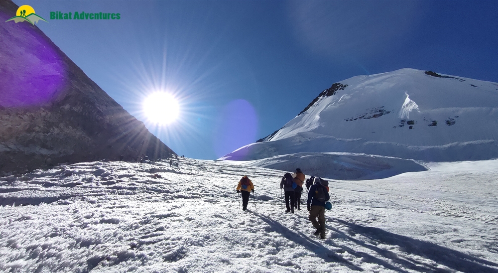
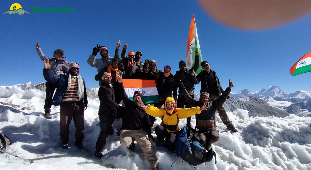
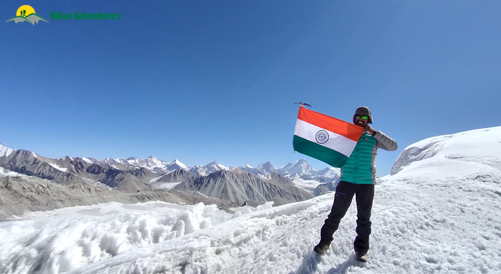
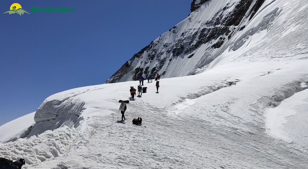
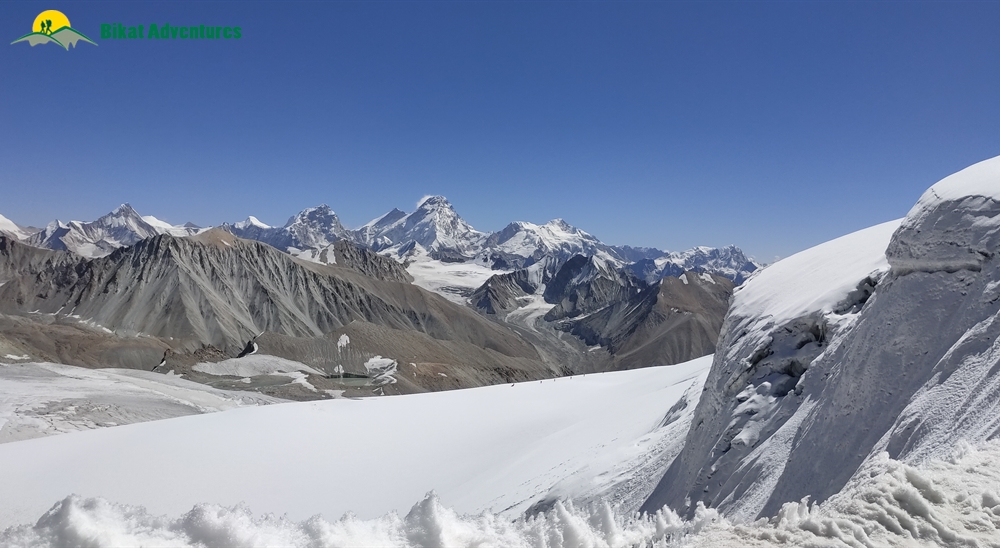
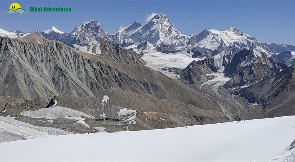
Kalindi Base Camp to Rajaparav (16,076 ft) via Kalindi Khal (19,488 ft) - 13 km
Today's the D Day and everybody should be up and ready early in the morning. Climb to the pass is not easy by any standard and hence a continuous pace is required till we reach the pass. Once you reach the pass you will realize that all the toil and hard work was worth every second. You will get spectacular views of Mt Kamet, Mt. Mana, Chandra Parbat, Vasuki Parbat and on a clear day a view of Tibetan Plateau as well. We will camp at Raj Parav today after crossing the glacial terrain.
Day 12
Rajaparav to Arwa Tal (14,763 ft) - 13 km
A long walk on glacier terrain leads to Arwa Tal.
Day 13
Arwa Tal to Badrinath (9,842 ft) via roadhead at Ghastoli (12,467 ft) - 12 km
After a long walk through the moraines we will reach Ghastoli today. On the way you will see terrain changing dramatically from grey to green a you get closet to Ghastoli. Ghastoli is a beautiful meadow and a treat for the eyes. Drive down the Mana Pass road to Badrinath.
Day 14
Badrinath to Dehradun - 295 km drive
We will board a vehicle for Dehradun. The drive to Dehradun is along the Alaknanda till Devprayag where it meets the Ganges. Board overnight Bus for Delhi from Dehradun.
Day 15
Reserve Day
This day will only be used if the need arises during the trek due to bad weather or unforeseen circumstances. You are advised to keep a buffer day in your travel plan. If the buffer day is used, you have to pay us Rs. 4500 per day (INR) +5% GST / per person. The amount will be collected by the Trek Leader.
What's Included
- Food as per menu on the trek starting breakfast on Day 3 till lunch on Day 13
- Forest Permits/Camping Charges, if any (upto the amount charged for Indian nationals)
- Tents, Sleeping bags, Sleeping mats
- Safety Equipment includes static rescue rope, seat harness, carabiners, pulleys
- Trek guide, cook, helpers, and porters for carrying common supplies
- Mountaineering course certified Trek Leader with Wilderness Emergency Responder & Rescue. course from NIM Uttarkashi
What's Not Included
- Portage of personal bags during the trek
- Cost of any kind of Travel Insurance.
- Any Expense of personal nature.
- Any Expense not specified in the inclusions list.
- Meals during hotel stay & road journeys
Are you Eligible for this Adventure?

BRS Level Required
This makes it mandatory for you to have high-altitude experience of preferably multiple treks marked at level 5 on the BRS. The altitude, the terrain and the nature of the climb demand a certain level of skill and a need for you to be aware of how your body reacts to the various features of high altitude environment.
If you do not know what level of BRS trek would suit you best, worry not! Fill out this Form:

we will send you a progression chart to help you comfortably get out of your comfort zone in order to level up and ultimately reach your highest potential in the big, bad world of outdoor adventure.
Packing List
This is a list of essential items for individuals doing the trek with Bikat Adventures. This list contains only those items which the participants are required to bring with them. The list excludes those items which are provided by Bikat Adventures on the trek. We have divided the items into five categories. All the items in the list are essential except for those marked as optional.
Trekking Gear
- Ruck sack bag with rain cover. Qty -1
- Day Pack Bag - Recommended for treks with summit day
- Head Torch with spare Batteries. Qty -1
- U V protection sunglasses. Qty -1 Here is how you can choose the best sunglasses for trekking.
- Water Bottles: 2 bottles of 1 liter each
Footwear
- Non-skid, deep treaded, high-ankle trekking shoes Qty -1
- Pair of light weight Slipper/Sandals Qty -1
Clothing
- Quick Dry Warm lower or Track Pants. Qty - 2
- Full sleeves T-shirts/ Sweatshirts. 1 for every 2 days of trekking
- Pair of thick woolen socks. 1 pair for every two days of trekking
- Thermal Body warmer Upper & Lower. Qty-1
- Undergarments. Qty - 1 for every day of trekking
- Warm jacket closed at wrist & neck .Qty-1
- Full sleeves sweater. Qty -1
- Rain wear ( Jacket & Pants ) . Qty-1
- Pair of waterproof, warm gloves. Qty-1
- Woolen cap. Qty-1
- Sun shielding Hat. Qty -1
Toiletries
- Personal toiletries kit (Small Towel, Toilet paper, paper soap, Bar soap, toothbrush, toothpaste, cold cream, etc.)
- Sun screen lotion small pack. Qty -1 Here is your Sun Protection 101 to stay safe in the bright sunny outdoors.
- Lip Balm small pack. Qty-1
Utensils
- Small size, Light weight & Leak proof lunch box. Qty-1
- Plate. Qty- 1
- Spoon.Qty-1
- Tea/Coffee (plastic) Mug.Qty-1
Miscellaneous
- Camera (Optional)
- Carry your medicines in plenty in case you have any specific ailment. Consult your doctor before joining the trek.
- Dry fruits, Nuts, Chocolate bars (Optional)
Frequently Asked Questions
Why Bikat?

Small Group Size
Our batch sizes are capped at 15 for smaller treks with the trek leader and trekker ratio of 1:8. This ratio, in our years of experience, has proven to deliver the best trekking experience for individuals as well as groups. Capping the size of the group ensures individual attention to each trekker so that no signs of distress or need during the trek go unnoticed. It also helps to form a more cohesive cohort with better group energy which helps define the rhythm and pace of days on the trek. As you go higher up on the BRS scale, since the stakes are higher, expeditions have an even smaller group size with the ratio of expedition leader to climber set at 1:2.

Qualified Trek Leaders
We follow a rigorous regime of hiring and training our experts in the field. Each trek leader is a certified mountaineer with years of experience in the field. In addition to their qualification, they also go through practical and situational training to tackle any and all kinds of sudden conditions that may present themselves on the ground. Being unpredictable is the core nature of the mountains but being ready for any circumstance as best as possible is a controllable asset that we try to nurture. Our field experts are also trained in basic medicine and first-aid response. Watch: Forerunners - The Making of A Trek Leader At Bikat Adventures

Guided Progression
Since Bikat Adventures is a learning-based organization, we help you climb up the ladder of difficulty within the sphere of outdoor adventure systematically. Our on-ground training modules are designed to handhold you through the upskilling process so that you are ready to take on bigger challenges.

Equipment Quality and Check
All the gear used on our treks and expeditions is tried and tested, maintained for good quality, and is overall top-notch in quality and condition. We are continually looking to obtain the best of everything there is in the market so as to ensure optimum safety.

Support Systems
Along with the staff you see on-ground, we have a team of superheroes working in the background to give you the best experience possible. Our background team also comprises local staff from each area who know the region best. Having local support helps with studying the area, pre-planning, execution, and in receiving timely support in case of emergencies in these remote locations.

Communication
Our on-field staff is in constant contact with our teams based in primary locations so as to eliminate any avoidable delay in reaching additional help and support when required. We try to use the best tools for communication available, including satellite phones, in regions where they are not restricted.
What our customers Say


Cancellation Policy
Cash refund
Cancellations up to 60 days prior to departure date
Between 60 days upto 30 days prior to departure date
Between 30 days upto 10 days prior to departure date
Less than 10 days prior to departure date
Voucher refund
Cancellations up to 30 days prior to departure date
Between 30 days upto 15 days prior to departure date
Between 15 days upto 10 days prior to departure date
Less 10 days prior to departure date
Please Note:
- Cash refund is applicable only in case of bookings made without using any promotional offer code or Cancellation Vouchers or Discounts
- This is only a brief of cancellation terms. For finer details please refer Detailed Cancellation Policy.
Blog Posts

Experiential
For the first time in a week since the start of the Kalindi Khal Expedition, genial merriment permeated the blanket of gloom that had enveloped the campsite of Nandanvan.
Settling down on a floor rumpled with boulders, Kulwinder, one of our particip...
Read full

Experiential
For the first time in a week since the start of the Kalindi Khal Expedition, genial merriment permeated the blanket of gloom that had enveloped the campsite of Nandanvan.
Settling down on a floor rumpled with boulders, Kulwinder, one of our particip...
Read full

Informative
During a full-fledged season of the Rupin Pass Trek some time ago, Pankaj (one of our founders) received a call about a bizarre situation that had developed on the slopes of the Rupin Pass. The call was from one of our guides who was assisting a batc...
Read full

Know How
I have trekked many places with these feet of mine and seen peak after peak with these eyes in my head. I have felt the burn in my thighs on the way up, the exhilaration at the top, the searing in my knees on my way back down and the exhausted conten...
Read full

Know How
Glaciers are water bodies made of dense ice that is continuously moving - rivers of ice - and are formed in regions where accumulation of snow in winter exceeds the rate of ablation (melting). Since they are constantly moving, and riddled with gaps o...
Read full
Similar Adventures

Auden's Col Expedition
A Stunning Cross-Over from Gangotri to Kedarnath - Not for the Faint-Hearted
Uttarakhand
16 Days
BRS 6
5490 m

Pin Parvati Pass Expedition
The Wildest Cross-Over Trek of India
Himachal
12 Days
BRS 6
5298 m

Parang La Expedition
An Ancient Trade Route between Spiti and Ladakh
Himachal
12 Days
BRS 6
5580 m


